
Trip Report: Lower Owyhee River - April 2019, 3400 to 2800 cfs
Lower Owyhee River
Submitted by Jeff Edwards
The OWA Newsletter said "John Day River, Stem to Stern", but it was not to be. After a very wet few weeks, the Nork Fork John Day was flooding, so our trip leader (Tom Riggs) decided to switch the first part of the trip to the lower Owyhee River. The moving target of a participant list was shuffled, and in the end 4 boats and 6 folks in the group showed up at the Owyhee: myself and my wife Margaret, Tom, Paul Morin (unofficial assistant TL) and brothers Van and Dennis McKay.
Arriving at the Rome put-in the evening of April 25 was a bit startling - cars and trucks and dust and people were everywhere! There were dozens of boats tied up at the ramp and up river. We found Tom and Paul rigging their boats, but it was too late for me to start rigging. The put-in at Rome is run by the BLM, and we found a place to set up our tent and cots - along with about 100 other boaters! They have drinking water available, and the Rome Station restaurant and gas station is nearby.
Day 1: Van and Dennis showed up with their boat on a trailer, but all had to wait for me to get my cataraft rigged. We got on the river about noon and floated about 8 miles down flat water and an upstream breeze to our first camp - a nice camp appropriately named "First Camp" on the BLM map.
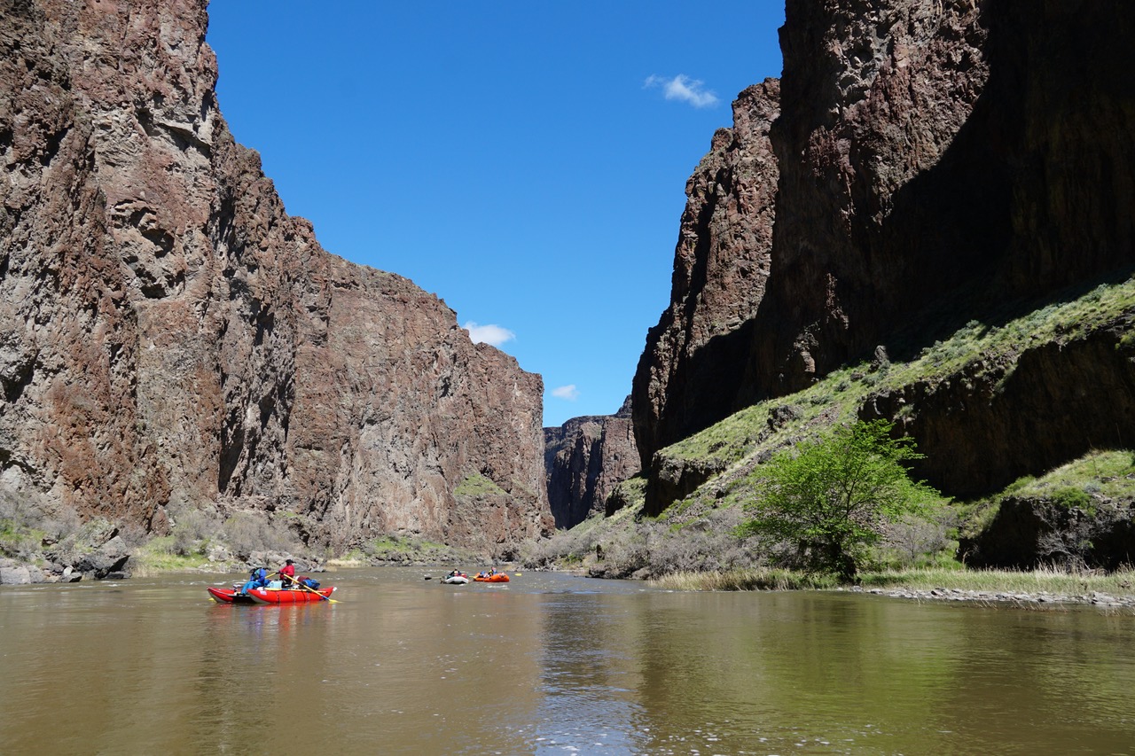
Day 2: We started running a bunch of fun Class II rapids and going through some beautiful canyons. The geology of the area is not only fascinating but has produced variably colored volcanic rocks and ash layers. We went about 17 miles and camped at "Pruitt's Castle" in the Lambert rocks area, a small high camp. This would have been a good place for a layover day as there are hiking trails that lead to Lambert Dome, a riverside mountain with especially spectacular scenery.
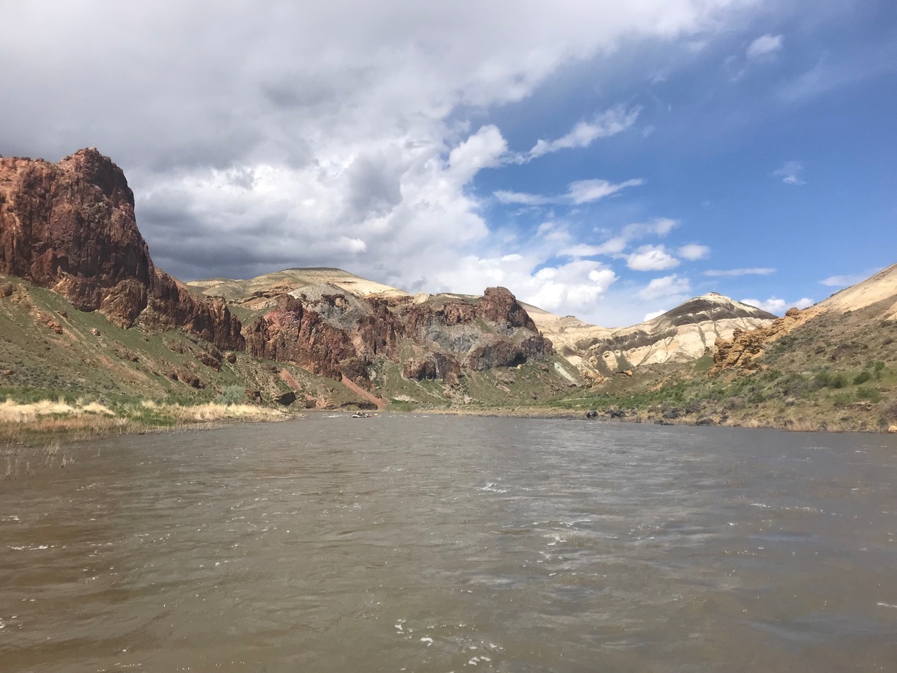
Day 3: We had more Class II's and a few Class III's; we scouted Whistling Bird and Montgomery rapids. After more sublime scenery, we went about 15 miles and camped at "Morcum", another nice camp with shade - not that we really needed shade, as it was relatively cool with the fairly constant upstream breeze. That night Van broke out his Dutch ovens and cooked up a great meal (game hens, potatoes, asparagus) and desert (cobbler).
Day 4: We had a few Class II's and we floated 11 miles down to the Birch Creek takeout. There were only a few other boats taking out there as we all de-rigged and then had lunch. Haylett had shuttled my Jeep and Tom's truck down there. My Jeep had apparently gotten a flat on the way in to Birch Creek, as the car jack was on the Jeep floor and the tire on the back was flat. Hmmm... this was a little concerning.
We took off before Tom as his truck and trailer were being loaded with the 3 deflated rafts. The first 5 miles out of Birch Creek are very steep and rocky, and sure enough I got another flat, which did not go totally flat until we were up on the plateau. After a while, Tom came by, and all 6 of us piled into his truck. Tom suggested we take the spare so we could get it fixed - a very good idea! Tom went out of his way to drop us off at a hotel in Ontario, we all had a late dinner, and then he continued on towards the John Day River for Part 2 of the trip. Margaret and I were not planning to do that part anyway.
We ended up renting a car, getting the spare repaired, drove 2 hours back to the Jeep, put the spare on, drove back to Ontario, got the other tire replaced (the hole was too big for Les Schwab to repair), returned the rental car, and drove on to Burns. Once we had internet service, I checked the Owyhee flows; at Rome the flow went from 3400 cfs to 2800 cfs during out 4-day trip - a really nice level. I had run it in 2017 at about 1800 cfs and it was rockier and slower. We had a day of birding at Malheur Lake Wildlife Refuge. As we left Burns, thinking about the switch to the Owyhee and help with our tire problem, Margaret remarked: "That Tom Riggs, he's a good problem solver."