Trip Report: Grande Ronde - May 2020, 6100 cfs
Grande Ronde River
Submitted by Eric & Candace Ball
The river access opened 4 days before put-in, so our 90-miles-in-three-days muscle fest was on. We had 9 people in 5 boats, launching from Minam (at the confluence of the Wallowa and Minam Rivers) at 8 AM Friday, May 8th. The weather was perfect, the flow was decent (6,000-6,300 cfs for the 3 days), but not strong. For this trip, higher flows flush us down the river faster and are an asset. The highest we've done the river was 13,00cfs, and nothing really gets harder; just faster.
Self-issue BLM permit at the put-in.
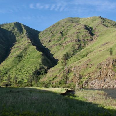
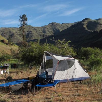
The first 10 miles are on the Wallowa River, at which point you join the Grande Ronde. The upper canyon (first 38 miles) has nice ponderosa pine as well as other evergreen and deciduous and even some flowering trees. Many very nice campsites exist here. We try to get one as low as possible in the canyon to make the long second day a tad shorter. This time, we took a great spot about 28 miles from the put-in. Good, large camps disappear at about 32 miles downstream from the put-in. Two nights in the upper canyon would be a luxury.
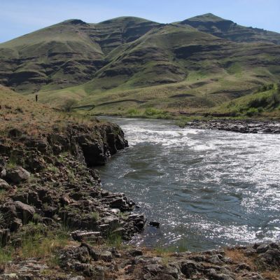
The first possible take out is Powatka Bridge, 39 miles downstream from the put-in, and this has the best landing of any take out. Troy, OR, is another 6 miles downstream (river mile 45) and has a small, rocky take out (river right just under the bridge). You can stop for a break and walk across the old metal bridge to use a flush toilet and get potable water, or buy beer at the small store/café. From here to Boggan's Oasis, a road follows the river and you can see the occasional house or ranch property as well as plenty of basalt. At river mile 26, we hit Boggan's Oasis which has a small Washington Fish and Wildlife take out, vault toilets and a short walk to a milkshake, burgers and fries (take out only, this year), as well as access to the Flora-Lewiston highway, featuring Rattlesnake Grade, supposedly one of the top motorcycle rides in the US.
From there, we pushed on to our second night's camp about 10 miles from the take-out (51 miles from our first night's camp). Camps on the lower canyon are not as nice as those in the upper canyon, so we've struggled to find a way to make the second day shorter. If it's sunny and hot, it might be hard to find a truly shady and pleasant spot, especially if you have more than 1-2 boats. We plan a dedicated lower canyon camp scouting trip next year, but everything we've checked out so far hasn't made the cut. The lower canyon is worth seeing early in the year because the high basalt lava flow bluffs are still covered with green grass and are impressive in their own right. Leftovers from old homesteading efforts can still be seen, and the rafting traffic is much lighter. There are a couple of camp spots at Schumacher Access that would be shaded later in the day, but this site also has gravel road access.
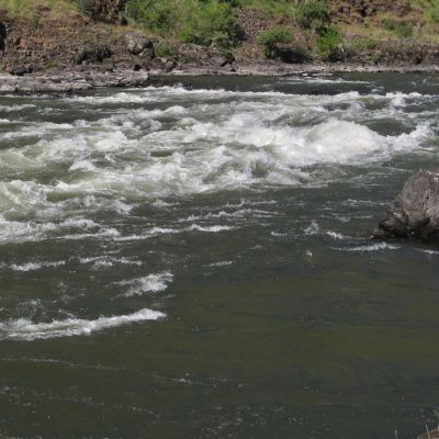
On day 3, we hit the Narrows Rapid, which scouts "bigger" than it would otherwise, because the Grande Ronde is such a tame river (the biggest hazard is not paying attention and getting stuck on a semi-submerged rock) that by contrast to what you've been through, it looks exciting. We've never had any carnage at any flow we've run (3,500 to 13,000). You can cheat it left or right, or run the gut. Scout it left.
Heller Bar is just after the confluence with the Snake on the Washington Side; don't forget your Washington State Discover Pass to have your rigs parked there. We had one person get a ticket there in many years. The short last day means that people are packed up and driving for home around noon, an advantage if you're coming from Portland or elsewhere on the West side.